-
Home
-
About
Introduce to Upazila
History-Culture
Geography & Economics
-
Upazila Parishad
Chairman Office
Monthly Meeting
Annual Development Plan
Upazila committee meeting
Others
বার্ষিক উন্নয়ন কর্মসূচি
বার্ষিক আর্থিক বিবরণি
-
Administration
About Organogram
Schedule & Meeting
-
Government Offices
Security & Discipline
Health Related
Agriculture & Food
Engineering & Communication
Human Resources
Education Related
-
Other Institution
Educational Institutions
Religious Institutions
- E-Services
- Gallery
The area of Dumuria upazila is 454.23 kilometers. The position of Dumuria upazila is 22 ° North latitude and 89 degrees east longitude. Khulna divisional city of southwest Bangladesh. Dumuria is the largest upazila of 9 upazilas of this district. Dumuria thana was established in 1918 and it was turned into Dumuria upazila in 1983.
Phultala, Abhaynagar and Manirampur upazilas on the north, Batiaghatta and Paikgacha upazilas on the south, Khanjahan Ali, Khalishpur, Sonadanga and Batiaghata upazilas on the east and Tala and Keshabpur upazilas on the west. Dumuria is situated just 15 kilometers west of the district headquarters.
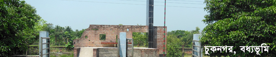
According to the historian Satish Chandra Mitra's "History of Jessore Khulna", Dumuria Bharat Bazar was under the rule of the 10th century. The authenticity of this statement appears in the Bharata Vayana Bharar Dulev's view of Jessore's Keshabpur upazila. In the middle of the fifteenth century, the propagation of Islam and Muslim rule in the Dumuria area was introduced. In 1984, an inscription was found in an old settlement near an ancient pond in Arshanagar village of Maguraghona union.The name of Hazrat Shah Afzal was found in that inscription. On the other hand, the zamindari of Haji Mohammad Mohsin was expanded in Dumuria region like West Bengal and other parts of Bangladesh. Another Muslim religion proponent, Shahjamal, is found in Andulia village in Dumuria.


Planning and Implementation: Cabinet Division, A2I, BCC, DoICT and BASIS
Technical Assistance:
![]()
Developed By:
